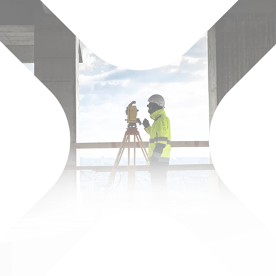
Represents a distinct branch of geodesy where, following the processing of classical images (RGB) or multispectral terrestrial or aerial (taken from the drone) , are provided geometric and physical information on objects, terrain or phenomena studied. Through photogrammetric techniques, the 2D information in the photographs is transformed into 3D information.
Our company uses a quadcopter drone (DJI Phantom 4 pro) capable of sustaining a flight (on load) of at least 25 minutes. It is equipped with a camera with 1 '' CMOS sensor and global shutter. The camera allows 4K (3840 x 1080p) video recordings and 20 megapixel photos (5472 x 2160 pixels).
The drone is able to perform missions completely automatically, ensuring the taking of aerial photographs from predetermined heights and with longitudinal and transverse coverage in accordance with the planned mission. We can obtain photos with the size of the pixel on the ground in centimeters or even millimeters.
View here the portfolio of works specific to photogrammetry.

Point cloud – generated by photogrammetry
The primary product of photogrammetry is the three-dimensional point cloud, which is colored according to the aerial photographs taken.
How accurate are these measurements?
The accuracy of these measurements depends on the photogrammetric camera used, the flight altitude, the longitudinal and transverse degree of coverage of the designed flight and the processing software. In general, following a correct photogrammetric reconstruction, accuracies of the order of 1-3 * GSD are obtained (GSD – average pixel size at ground level).
Ex. If a flight with GSD designed by 5mm is executed then the planimetric accuracy will be between 5mm-10mm and the altimetric accuracy between 5mm-15mm.

3D digital model of the surface
It is generated based on the three-dimensional point cloud, the result being a 3D mesh model on which a texture generated from the taken photos can be mapped. The digital surface model contains the elements directly visible in the photos such as: vegetation, building roofs, etc.

Orthophotoplan or photogrammetric mosaic
The orthophoto plane represents a composition of the images (frames) taken by the drone. This “composition” is not just a distorted paste. The orthophotoplan is a metric image, free of distortions generated by the photogrammetric and relief camera, made in a well-established projection system (eg Romania’s national projection system – Stereo ‘70). Its resolution can be centimeters or even millimeters and the accuracy is calculated similarly to the example from the point cloud.

Photogrammetric processing
Our company performs photogrammetric processing using two graphics stations: HP Z800 equipped with two Intel Xeon X5675 hexa-core 3.06 GHz processors, 64 GB DDR3 RAM, NVIDIA GeForce GTX 1070 8GB graphics card and HP Z440 Model, Intel Xeon E5-2690 v3 2.6 processor GHz, 64GB RAM, NVIDIA Quadro K4200 4GB graphics card.
What is the required data?
- aerial photos with or without geotag
- 3D coordinates for marked control points at ground level or,
- inventory of 3D coordinates (PPK or RTK determinants) of shooting centers
What software is used for photogrammetric processing?
Processing is done with Pix4D Mapper software Pix4D Mapper; the personnel involved in this operation have an accreditation issued by the manufacturers of the processing software.
How long does this service take and how much does it cost?
The time varies depending on the number of photos and their resolution. For a price offer do not hesitate to contact us..

Specialized software training
For Pix4D Mapper software (which we recommend for photogrammetric processing required in the field of geodesy) but also for AgiSoft Metashape we organize training courses. These last for two days and include both theoretical notions: basic theoretical photogrammetric aspects, optimal camera settings, preparation of the flight mission, and practical notions: which details the operation and use of processing software..

Photo and video investigations
We make drone footage and aerial photography for infrastructure project investigation projects. The final product contains information taken from the drone’s log.

Photo and video investigations
We do filming and commercial aerial photography. Products can be delivered with or without post processing.

Virtual tour
Virtual tours are a composition of 360-degree panoramic photos taken with spherical cameras or the Leica RTC360 laser scanner, the photos taken by the scanner (12MP x 3 x 5 HDR exposures) are composed in the import process to generate 360 HDR panoramas in rectangular projection. They have an exceptional quality and resolution.
Find out here more about virtual tours here.