3D laser scanning
The fastest and most accurate way to measure
3D laser scanning
all the information in a single scanning session
Eficiență
Siguranță

Valori
3D laser scanning – An approach through which the work of specialists can be significantly simplified, while the results that can be achieved through its use are numerous and impressive.
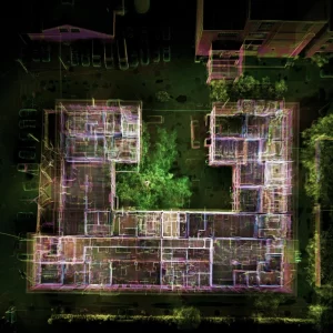
3D scanning is a measurement process in which spatial data (point cloud) is collected.
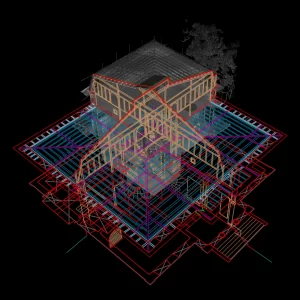
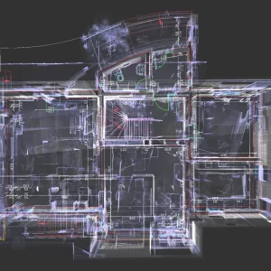
The point cloud arising from the 3D scanning process is processed to generate a broad and detailed image of the project through complex 3D models and 2D drawings, provided according to the level of detail chosen by the client – LOD 100, 200, 300.
This process accurately determines the surfaces of objects or buildings, as well as degraded areas, geometry, position, thickness, and verticality of existing walls. It is useful in carrying out surveys, cross-sections, façades, 3D models of constructions, or the digital terrain model (DTM).
3D laser scanning plays an essential role in the modernization and automation of workflows and work processes in the construction industry and beyond.
Fields of application for 3D scanning include:
- Civil, industrial, architectural, and heritage construction.
- Demolition of structures and rehabilitation of building façades.
- Historical monuments and cultural heritage.
- Determining the flatness/verticality of the built elements.
- Mesh representation (3D representation of object or terrain surfaces).
- 360-degree photos necessary for virtual tours.
- Surveys for designing façades during construction.
- Surveys for calculating surface areas according to BOMA standard.
- Special effects.
- 3D modeling.
- Scan-to-BIM (Scan to Building Information Modeling).
- Bridges, viaducts, tunnels, and railways.
- Archaeological sites.
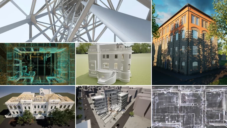
Deliverables obtained from 3D laser scanning:
- Point cloud
- 360-degree panoramic photographs
- Orthophotoplan generated from the point cloud
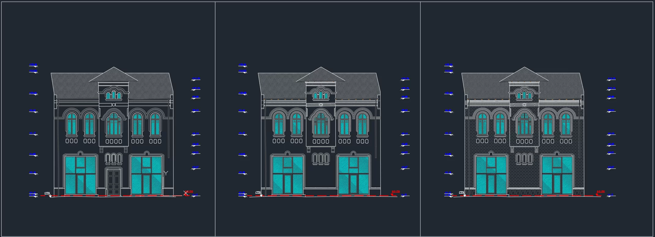
- 2D plans and surveys of vertical sections / façade surveys
- Site plans
- 3D Model - BIM (Building Information Modeling)
- 3D Model – Mesh
- 3D Model – DTM (Digital Terrain Model)
- Other types: plans highlighting the flatness and verticality of surfaces
- Volumetric reports for different scanned areas
- Monitoring reports of the behavior of constructions over time
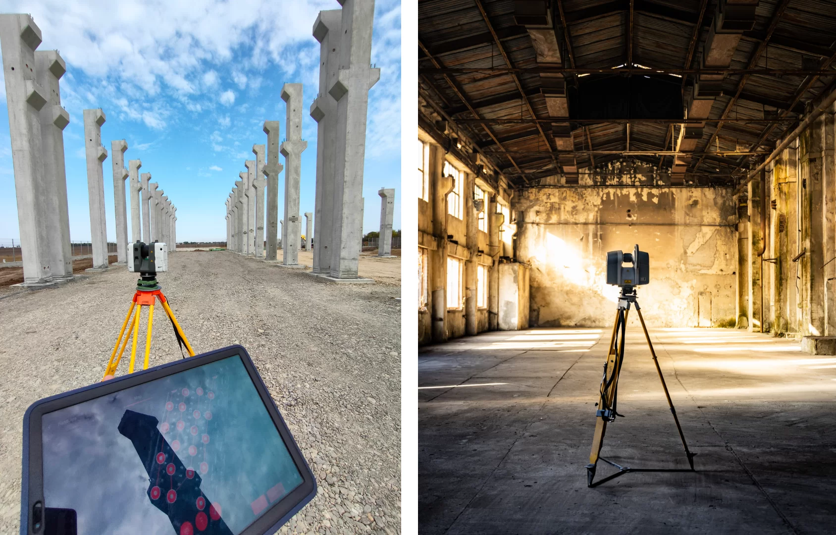
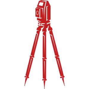
Scanner RTC 360
- The world's fastest laser scanner
- The first equipment in the world equipped with a VIS positioning system (for indoors)
- Equipment capable of capturing a 360 panorama with 5 HDR exposures in one minute.
The Trimble TX8 is the standard in performance and speed when it comes to collecting 3D data.
- The complete 3D digital model for construction/objects.
- The 3D BIM model for architects, designers, and builders (Building Information Model).
- Precise measurements for the entire scanning range (up to 340 meters).
Benefits of 3D laser scanning include:
- High speed of data acquisition
- Recording millions of measured points in a matter of seconds.
- Maximizing safety for all involved parties (the data is collected from a safe distance).
- Significant reduction of time and costs.
- Realistic depiction of the project.
- Detailed information captured in a single point cloud.
3D scanning deliverables:
1.2D plans/horizontal sections required for:
- Helpful design/remodeling support
- BOMA surveys required for determining rentable spaces
- Survey and real estate Registration
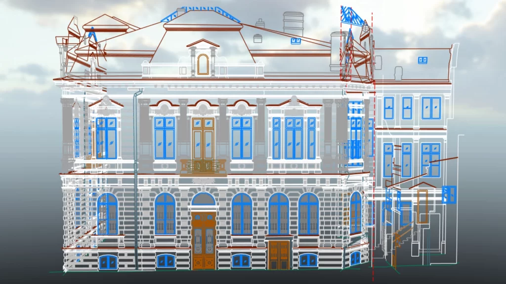
2. Façade plans/surveys needed for:
- Refurbishments or renovations (particularly in the case of historical buildings where the original architecture must be protected)
- Calculating areas and associated repair costs
- Highlighting less visible areas affected by deterioration
- Useful support in design/renovation
3. Obtaining cross-sections and longitudinal sections required for:
- Determining wall thickness
- Refurbishing interior spaces
- Useful support for the designer/architect
4. Obtaining the 3D and BIM models necessary for:
- al-time refurbishing by moving furniture, checking the position of future elements, checking circulation areas, (re)designing facilities
- Creating videos that represent the space
Eurosurvey 3D scanning projects
- Topographic survey, 3D laser scanning - floor flatness, cross sections, interior mapping according to BOMA standard, land registration, topographic elevation and planimetric survey, altimetric and planimetric survey.
- Facades, attic plan, cross sections, roof plan, floor plans, 3D model
- Facades, cross sections, facades, level plans,roof plan, topographic surveys
- Floor plan and vertical sections for the hotel’s 4th floor
- Floor plans and facades for determining verticality, georeferencing, construction behavior tracking in time
- Floor plans, cross sections and facades for the residential building and annex
- Cross sections / floor plans / construction facades (North, South, West, East)
- 3D survey site study/floor flatness/floor plans/determining BOMA rentable spaces