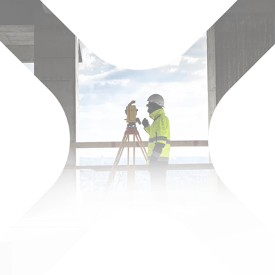
XPLORATE - YOUR PARTNER IN TOPOGRAPHIC MEASUREMENTS
Your solution for topographic, geodetic, photogrammetry and 3D laser scanning measurements

Our partners















About us
Xplorate Group is about people and authentically expressed values, with over 18 years of experience and a shared vision derived from the merger of EUROSURVEY & TOTAL SURVEY), focused on delivering quality services
Our team consists of specialized engineers in topographic measurements, geodesy, photogrammetry, 3D laser scanning, land registration and survey engineering, with a national and international coverage.
Xplorate by numbers
In a world filled with numbers and coordinates, Xplorate Group is here with the needed expertise to help you achieve your goals, all attained with minimal consumption of resources and energy.
19
years of experience
426
major projects completed
9.450
survey documentations
1.048,147
sqm in scanned areas
545
km of road measured
1.900,431
sqm built measured (buildings)
2490
ha of land measured
15.845
apartments registered in the Land Registry
Projects
Our portfolio of services includes consultancy and execution in the topo-geodetic field, our team having experience both locally and internationally.
We provide customized solutions for topographic, geodetic, photogrammetric, and 3D laser scanning measurements, catering to both large-scale projects and individual residences, while adhering to project timelines.
- Construction behavior tracking in time.
- Real estate registration, construction registration, documentation to declare subdivision into flats, land dismantling.
- Topographic survey, 3D laser scanning - floor flatness, cross sections, interior mapping according to BOMA standard, land registration, topographic elevation and planimetric survey, altimetric and planimetric survey.
Services
To achieve your goals with minimal consumption of resources and energy.
We are at your disposal with all the necessary support
Testimonials


