


I am the primary VFX Supervisor for the HIT Netflix Series, Wednesday, filmed in Romania in the fall of 2021. Wednesday is Netflix’s second most viewed show in the company’s history, enjoying both critical and popular success. I have been nominated for 12 2023 Prime Time Emmy awards.
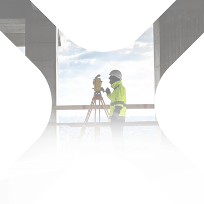
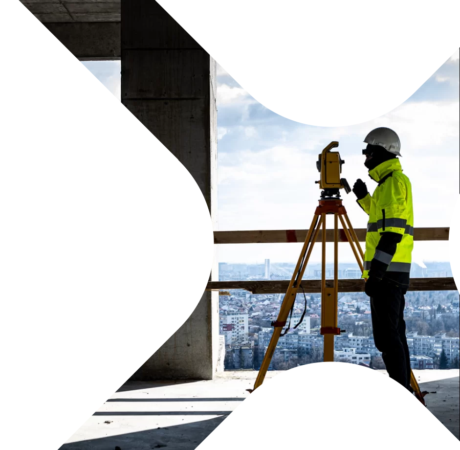
We engaged Xplorate Group to provide location scanning services for all our Int. Sets and Locations.
We wanted to take a moment to share our heartfelt recommendation for Xplorate Group and their outstanding services. As an industry leader in entertainment, we have had the pleasure of collaborating with various partners to bring the best experiences to our viewers. Xplorate Group has consistently proven themselves as a reliable and innovative service provider, making them a top choice for us.
One of the key aspects that sets Xplorate apart is their diverse portfolio. Their extensive range of services caters to a wide spectrum of needs, ensuring that each project is handled with utmost professionalism and expertise.
Xplorate's cutting-edge technology and skilled team enable them to capture precise and intricate details, elevating the overall production value of any project.
Moreover, Xplorate Group goes the extra mile by providing comprehensive maintenance and support even after the project is completed. Their dedication to customer satisfaction is unwavering, and they ensure that their clients' needs are met long after the final deliverables are handed over.
Xplorate's commitment to building long-lasting partnerships is truly remarkable.
In summary, Xplorate's diversified portfolio, top-notch services, and exceptional post-project support make them an outstanding choice for any organization seeking excellence in their projects. We recommend Xplorate Group for their professionalism, expertise, and dedication to delivering exceptional results.
Their services and professionalism is exceptional, I have since recommended them to other productions and they can be proud that Netflix considers them part of their trusted vendor network.
Warm regards,

Stakeout of the designed elements is an essential phase in the construction process. The Xplorate team adds more safety and a quicker pace to our portfolio projects. We shall maintain our collaboration as they are indeed specialists.

Our company had a real benefit from the collaboration with Xplorate Group. We were supported and guided by their team since the very first discussions until receiving the documentation, in relation to all concerned authorities. We have found within your company a qualified group of professionals, ready at any time to come up with solutions for any problem that we challenged.

At Alterman, we focus on teams to collaborate consistently, maintain the technical language of expertise and achieve the results we aim for as a whole.
Xplorate Group is the ideal choice for us in this direction, the work carried out in partnership with them is always a benchmark for collaborations we want to keep in the long term.
We worked with them on distmantling the land, enrolling and subdivision into flats, registration and parcelling, final survey registration, PUD technical reception and if there were a star rating system, the Xplorate team would definitely give them the maximum score.

We worked with the Xplorate team on both the topographical surveys and OCPI approvals.
We have found in our collaborators an example of a well-knit team, a form of organisation designed to simplify complex services and an ally in the progressive development of the projects carried out.
We recommend them as professionals and are happy to be part of exciting projects together.
Xplorate Group is the ideal choice for us in this direction, the work carried out in partnership with them is always a benchmark for collaborations we want to keep in the long term.
We worked with them on distmantling the land, enrolling and subdivision into flats, registration and parcelling, final survey registration, PUD technical reception and if there were a star rating system, the Xplorate team would definitely give them the maximum score.

We believe in long-term recommendations because they can provide an overview of a project's development from all points of view.
As far as the Xplorate team is concerned, the words that best sum up our collaboration are: professionalism, dedication and speed.
We confidently recommend them for engineering surveying services, building registration, subdivision into flats, land clearing, 3D laser scanning and interior mapping.

We would like to express our appreciation for the collaboration with Xplorate Group.
The collaboration between the two companies started in 2010 on the engineering surveying services side, high-precision measurements, scans or 3D models.
We have chosen them all this time because of the high quality, the services provided, the accuracy of the details captured,
for the professionalism and openness with which they treat each project and especially for the dedication they have given
dedication. Each project has different needs and requirements, having the expertise and the necessary team can bring major advantages, both to the project and to the optimization of the development and construction process in local / European market conditions.
The professionals with whom you build / develop are the most important resource.
In view of the above, we allow ourselves to recommend Xplorate Group as a professional one and a reliable partner for any company you will relate with.

When we talk about subdivision, building registration, dismantling, updating, facade mapping, topographical assistance on site, topographical survey for design and approval, professionalism and attention to detail are extremely important qualities and working with the Xplorate team has shown us that we made the right choice.
The professionalism they showed, the constant collaboration and the results obtained made us put them on "speed dial" when we want to work with the best.
We recommend them to all those who need exemplary services, harmonized with the legislation in force and passed through the filter of a team of professionals.

We have worked with Xplorate Group on construction works that involved the preparation of field measurements and technical documentation for land clearance, building registration, subdivision and we met in our collaboration a team of professionals extremely responsive to the needs of its customers, ready to offer quick solutions when the situation requires it and ready to take all necessary steps to achieve optimal results.
Our recommendation for the services provided confirms the excellent potential of the work carried out in partnership with a team of professionals.

A long-standing partner, Xplorate Group consistently supports the WDP in all its local projects. Over the years, Xplorate has shown promptness and commitment by being at our side, every time, to carry out land registration, cadastral measurements, annexations or flatness measurements to the highest standards.
Thank you Xplorate Group for your dedication, we are proud to have such a partner, with whom we contribute to the expansion of the real estate sector in Romania

Xplorate Group is one of WDP's long-standing partners, worked with them for more than 6 years. Throughout this period we have carried out together multiple projects of topographic survey, interior mapping according to BOMA standard, survey and land registration, in cities such as Timisoara, Craiova, Constanta, Deva, Ploiesti or Buzau, and the list goes can continue. We are glad to have a partner like Xplorate Group, their experience makes all the difference in all the projects that WDP carries out in Romania.

With a large-scale work such as the 3D scanning and modeling of 4 buildings in Constanta County, the need to choose a team to travel on site, to have state-of-the-art equipment and to benefit from professionals who could translate the measurements into 3D models led us to collaborate with Xplorate Group. The results obtained bear the mark of common sense and experience that recommends Xplorate for works that are easily noticed.

Fruitful collaborations yield beautiful results, and for the best of them, we always keep the appropriate words. We collaborated with the Xplorate Group team to carry out a topographic site survey and obtain OCPI approval for the railway station in Constanța. The professionalism they demonstrated, the technical assistance provided throughout the work, and the results obtained keep them at the top of our preferences for this sector of construction works.